


DOVER WARD 2, Strafford County, New Hampshire
About
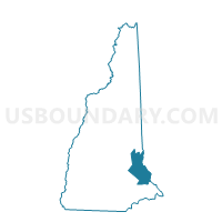
Outline

Summary
| Unique Area Identifier | 616467 |
| Name | DOVER WARD 2 |
| County | Strafford County |
| State | New Hampshire |
| Area (square miles) | 2.81 |
| Land Area (square miles) | 2.34 |
| Water Area (square miles) | 0.47 |
| % of Land Area | 83.13 |
| % of Water Area | 16.87 |
| Latitude of the Internal Point | 43.19422910 |
| Longtitude of the Internal Point | -70.84598620 |
Maps


Graphs
Select a template below for downloading or customizing gragh for DOVER WARD 2, Strafford County, New Hampshire


Neighbors
Neighoring Voting District (by Name) Neighboring Voting District on the Map
- Voting District 011484, York County, ME
- Voting District 011485, York County, ME
- DOVER WARD 1, Strafford County, NH
- DOVER WARD 3, Strafford County, NH
- DOVER WARD 5, Strafford County, NH
- TOWN OF ROLLINSFORD Voting District, Strafford County, NH
Top 10 Neighboring County Subdivision (by Population) Neighboring County Subdivision on the Map
- Dover city, Strafford County, NH (29,987)
- South Berwick town, York County, ME (7,220)
- Eliot town, York County, ME (6,204)
- Rollinsford town, Strafford County, NH (2,527)
Top 10 Neighboring Place (by Population) Neighboring Place on the Map
Top 10 Neighboring Elementary School District (by Population) Neighboring Elementary School District on the Map
Top 10 Neighboring Unified School District (by Population) Neighboring Unified School District on the Map
Top 10 Neighboring State Legislative District Lower Chamber (by Population) Neighboring State Legislative District Lower Chamber on the Map
- State House District 2, Strafford County, NH (14,293)
- State House District 6, Strafford County, NH (10,996)
- State House District 5, Strafford County, NH (9,897)
- State House District 4, Strafford County, NH (9,094)
- State House District 148, ME (8,974)
Top 10 Neighboring State Legislative District Upper Chamber (by Population) Neighboring State Legislative District Upper Chamber on the Map
Top 10 Neighboring 111th Congressional District (by Population) Neighboring 111th Congressional District on the Map
Top 10 Neighboring Census Tract (by Population) Neighboring Census Tract on the Map
- Census Tract 350, York County, ME (7,220)
- Census Tract 370, York County, ME (6,204)
- Census Tract 815, Strafford County, NH (5,721)
- Census Tract 813, Strafford County, NH (4,531)
- Census Tract 812, Strafford County, NH (4,492)
- Census Tract 820, Strafford County, NH (2,527)
- Census Tract 814, Strafford County, NH (1,831)